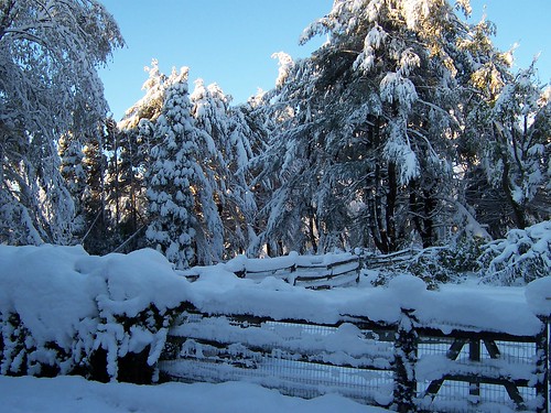
According to the United States Census Bureau, the town has a total area of 41.47 square miles (107.4 km2), of which, 41.26 square miles (106.9 km2) of it is land and 0.21 square miles (0.54 km2) of it (0.51%) is water.[4]
Hammonton borders the Borough of Folsom, to the southwest, and both Hamilton and Mullica townships to the southeast. It also borders Camden County to the northwest, and Burlington County to the north east. It is located in the Atlantic Coastal Plain, so is largely flat, though the highest point in Atlantic County is located along the Pennsylvania Railroad within the borders of Hammonton. Due to its proximity to the Pine Barrens, the soil is largely sandy, making it ideal for growing blueberries. Low, marshy areas, often within the Pine Barrens are also used for cranberry cultivation.
Hammonton has a humid continental climate bordering on a humid subtropical climate, characterized by brisk winters, hot summers, and plentiful precipitation spread evenly throughout the year. Source: Wikipedia.

20120326
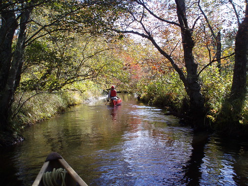
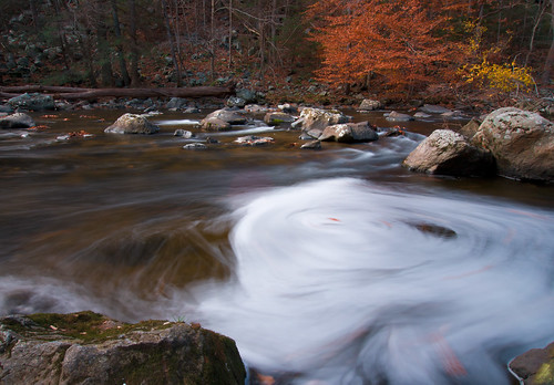
Mullica River, Hammonton, New Jersey
Ventnor City, New Jersey
![[105/365] all else fails by Robert Bruce Murray III // Sort Of Natural](http://farm3.staticflickr.com/2601/3883442688_355ea53083.jpg)
Mrs. S. Bartram Richards, the wife of the secretary-treasurer of the land company, suggested the name "Ventnor" for the area being developed in Atlantic County by the Camden and Atlantic Land Company south of Atlantic City, having recently visited the seashore resort on the Isle of Wight with the same name. The name was chosen in January 1889. The city was formally incorporated by the New Jersey Legislature on March 17, 1903.[22]
Chapter 51 of the laws and Sessions of the State of New Jersey provided the noble beginning to Ventnor City stating, "Be it enacted by the Senate and General Assembly of New Jersey that all part or portion of the County of Atlantic, formerly a part of Egg Harbor Township, situated on Absecon Beach, lying between the Westwardly limit of Atlantic City and the Eastwardly limit of South Atlantic City, the Atlantic Ocean on the south as far as the jurisdiction of the State extends, and to the center of Beach Thoroughfare on the North, be, and is hereby constituted as a City of this State, and all of the inhabitants of the State residing within the limits aforesaid be and they are hereby ordained, constituted and declared to be from time to time forever hereafter one body politic and corporate, in fact and in name, by the name, Ventnor City. This act shall take effect immediately, and was approved on March 17, 1903."[22]
These meetings were originally held in the Carisbrooke Inn, which was located behind the present City Hall, on Atlantic Avenue between Cambridge and Sacramento Avenues; Carisbrooke is also a place name taken from the Isle of Wight. The first meeting was held on April 20, 1903, with a follow up meeting being conducted on April 27, 1903. Source: Wikipedia
Firehouse, Boonton, New Jersey
Boonton is a Town in Morris County, New Jersey that was chartered in 1867. As of the 2010 United States Census, the town population was 8,347.[4] The town was originally called "Boone-Towne" in 1761 in honor of the Colonial Governor Thomas Boone.
Boonton was originally formed on March 16, 1866, within portions of Hanover Township and Pequannock Township. The town was reincorporated and became independent on March 18, 1867.[8]
Today's Boonton began in about 1829, as a result of the construction of the Morris Canal and the development of the New Jersey Iron Company. The original location of the town is now largely under the Jersey City Reservoir, completed in 1904. The waters from this reservoir were the first municipal water supply in the United States to be chlorinated in 1908. Source: Wiipedia
20120324


20120322

20120301


Califon Train Station - New Jersey
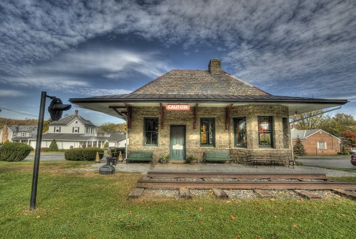
Califon Train Station - New Jersey, a photo by flying cats on Flickr.
Califon was a station on the High Bridge Branch of the Central Railroad of New Jersey. The rail line was abandoned in 1976 and now serves as a Hunterdon County-administered rail trail called Columbia Trail, which runs south to High Bridge and north to points in Morris County.
Though the mills were present in the area of Califon for some time prior to its incorporation as a town, it was quite a while before growth became evident in the mid-nineteenth century. It was first called California, from Jacob Neighbor's enthusiasm in the milling business about the time the California Gold Rush broke out. The Borough was incorporated by an Act of the New Jersey Legislature from portions of both Lebanon and Tewksbury Townships on April 2, 1918.[9]
Local legend has it that California became a regular stop for weekend excursion trains through the countryside. When riders bought their tickets they were issued a voucher good for an ice cream; the train would stop so tourists could wander around and cash in their ice cream coupons. Anxious to exploit this source of outside revenue, residents petitioned the Railroad to let them build a real station, which they did as a community project. The station is said to be the one shown in the picture on the right. Citing the local account again, two sign painters who came to letter the sign rode the train from Dunellen, but the background paint wasn't dry when they arrived. They sat and drank at the hotel, which later burned down. By the time the sign was ready for their artistic touch, the local tale says, "Califon" was as close to California as the inebriated painters could manage.
Califon is also situated just north of the Kenneth Lockwood Gorge on the South Branch of the Raritan River; this pristine stretch of clear water and forest is a well-known treasure for New Jersey trout fishermen.
The Califon Historical Society has registered 170 structures with the National Register of Historic Places. Califon is a Victorian-style enclave where the houses are marked with the names of the builders and their dates of establishment rather than with street numbers.
The center of Califon is the historic iron bridge spanning the South Branch of the Raritan River, which divides the borough. Recently the State of New Jersey announced they were going to replace the bridge, using the fact that a loaded school bus represented more weight than the aging bridge could safely carry. Incensed citizens objected, protective of the landmark, and found a colorful but simple solution; the school bus stops at one end of the bridge unloading the students, who then walk across to the other side. Then the empty bus, within imposed weight limits, drives across and the students get back on the bus to continue their ride. Thus the bridge was saved. (Account featured on Califon website).
Califon became a regional household name when frequently mentioned by Merv Griffin on his TV show during the 1970s. He and his wife Juliette owned a home in nearby Lebanon Township, which had a Califon mailing address, and, while they were married, they were often seen visiting the village in a fringed-top Bermuda-style resort cart. Califon Productions created all of his television ventures.